
Road Maps of Brittany and France
Sat Nav systems are commonly used today but we can all recall of occasions where the software insists on taking us "elsewhere" than our final destination ! So to avoid such frustrating situations, be prepared and buy a reliable paper map.
Browse through our selection of folded road maps of Brittany and spiral bound A3 atlas of France.
Browse through our selection of folded road maps of Brittany and spiral bound A3 atlas of France.
France Map: Brittany/Normandy West Sheet 2 
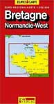
Product Description
This updated GeoCenter Euro Map of Brittany now features grid references in the margin to aid quicker orientation. Additional colour changes to the mapping make transport networks clearer than before. With a scale of 1:300 Thousand and a legend in 8 languages, this is a comprehensive and indispensible road map which folds for ease of use. Tourist information, places of interest and a street index are all featured. Information is provided on hotels, restaurants, museums, theatres, parks and gardens, with tourist attractions clearly indicated and public transport systems marked.![]() More information & buy from Amazon
More information & buy from Amazon
The Rough Guide Map Brittany

Product Description
Brittany is one of the most popular regions of France, with highlights including Mont-St-Michel and the medieval city of Rennes. The Rough Guide map is ideal for those touring by car - a popular option amongst visitors from the UK and Ireland. The map includes all the ferry routes into St Malo, and all the roads across the region from autoroutes to tracks. There are also footpaths and contour lines for those hiking around the national parks and coastlines. As with all the maps in the Rough Guides series, this map is made of rip-proof, waterproof Polyart paper, durable enough to survive a trip spent in the car seat-back, rucksack, and cafe table-top.![]() More information & buy from Amazon
More information & buy from Amazon
Brittany Map (AA Road Map France Series)
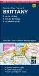
Product Description
Fully updated, this folded map combines clear design and an easy-to-read scale with more road detail to ensure that you never lose your way. It includes information on toll points, service areas, road numbers, motorways, dual carriageways and wide and narrow local roads. National Parks, visitor attractions and towns and places of interest are also highlighted. The map is presented in a practical slimline format, with a durable weatherproof cover for protection from the elements.![]() More information & buy from Amazon
More information & buy from Amazon
Big Easy Read France 2010 SP (AA Atlases and Maps)
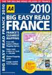
Product Description
Fully revised and updated for 2010, this specialist A3 spiral bound road atlas designed for the British motorist in France includes 44 city, town and port plans and a new style central Paris city plan. Coverage includes road mapping for Corsica, and there is a channel hopping guide, channel tunnel terminal and channel tunnel port plans. The atlas is giant scale throughout, making it very easy-to-read and mapping is provided by the AA and the Institut Geographique National (IGN), the experts on roads in France.![]() More information & buy from Amazon
More information & buy from Amazon
France 2010 - atlas (A3-Spiral) (Michelin Tourist & Motoring Atlases)
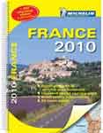
Product Description
A fully updated Michelin A3 road atlas, spiral bound, scaled 1:200,000. An ideal complement to sat nav systems.![]() More information & and buy from Amazon
More information & and buy from Amazon
Search a Hotel in Brittany
Brittany Top Holiday Destinations
Northern Coastline | ||
 Emerald Coast |
 Pink Granite |
 North Finistère |
Southern Coastline | ||
 South Finistère |
 Morbihan |
 Loire-Altantique |
Brittany Top Holiday Attractions
 Beaches |
 Castles |
 Festivals |
 Villages |
 Canals |
 Churches |
 Islands |
 Top Towns |
Bookstore

